Storm Goretti heads to UK bringing more snow, ice and wind
BBC | 08.01.2026 08:48
The UK is braced for widespread heavy snowfall and strong winds as Storm Goretti moves across the country on Thursday.
The Met Office has issued an amber warning for snow and heavy winds in parts of England and Wales, alongside a number of yellow weather alerts spanning larges swathes of the UK.
The AA urged drivers to take "extreme care" due to the risk of black ice, after nine children were injured in a collision between a school coach and a bus in Reading on Wednesday.
Goretti, named by French forecasters, is likely to undergo "explosive cyclogenesis" - also known as a "weather bomb".
The term explosive cyclogenesis is used where the central pressure drops by 1 millibar (mb) an hour over a 24-hour period. It generally results in particularly powerful gusts of wind over a period of a few hours.
The snow and icy conditions have also caused widespread travel chaos across Europe, with thousands of people stranded at airports in Paris and Amsterdam as flights were cancelled.
At least six people have died in weather-related incidents across Europe this week - five in France and one in Bosnia.
Shaun Jones, AA expert patrol, urged drivers to consider delaying their journey or work from home if possible, adding wintry conditions could "reduce visibility in seconds" leading to familiar routes becoming "hazardous very quickly".
The BBC heard from one man who said he was driving "very carefully" with his wife, on the A887 to Edinburgh, when a tree suddenly fell on their car.
"It was quite unbelievable," said Gerard Cairney, adding that the tree "bounced" off his bonnet. He was able to swerve, avoiding any serious damage, bar some minor scratches on the paintwork.
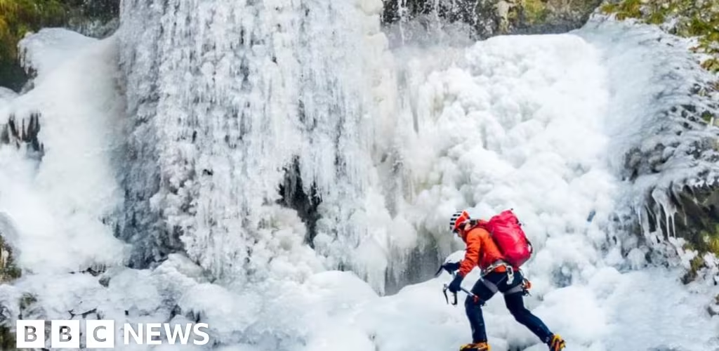
A volunteer mountain rescuer was pictured scaling a frozen Gordale Scar waterfall in the Yorkshire Dales National Park after temperatures dropped in parts of the UK.
"I've done it probably three times in the last six years," said Mick Ellerton, an experienced climber. "It very rarely comes into (the right) conditions".
Where are the weather warnings?
Amber warnings for heavy snow are in place in the following areas from 20:00 Thursday to 09:00 on Friday:
- The Midlands
- Wales
- South West England
- Yorkshire & Humber
An amber warning for strong wind has also been issued from 17:00 - 23:00 Thursday in parts of South West England:
- Cornwall
- Isles of Scilly
Yellow weather warnings for snow, ice and rain are also in place for the following areas:
- Scotland (snow and ice) 22:00 Wednesday - 12:00 Thursday
- Devon and Somerset (snow) 20:00 Thursday - 09:00 Friday.
- The Midlands, Yorkshire, Wales, North West and South West England, North East England, East of England, London and South East England (snow) - 17:00 Thursday - 12:00 Friday.
- Northern Ireland (ice)- 00:00 - 10:00 Thursday
- Lincolnshire and parts of East of England including Cambridgeshire, Norfolk, Peterborough and Suffolk (rain) - 18:00 Thursday - 21:00 Friday
- London and South East England, Pembrokeshire in Wales and South West England (wind) - 15:00 Thursday to 06:00 Friday.
Storm Goretti is expected to rapidly develop as it approaches south-west England by midday on Thursday.
Later on Thursday afternoon, parts of Cornwall and the Isles of Scilly could see gusts of up to 90mph, bringing the risk of falling debris and potential danger to life.
As rain then spreads northward across England and Wales, it meets the colder Artic air we have had in place over the past week, resulting in the rain turning to snow by Thursday evening.
Mid and East Wales, the Midlands and up to the southern Pennines will see the greatest likelihood of significant snow, with 10-15cm likely, with the potential for 20-30cm, more especially on the hills of Wales and the Peak District.
In the West Midlands, local authorities said they were preparing for potentially the worst snowfall in a decade.
Heavy rain could also bring some localised flooding to parts of south-west Wales and Eastern England.
Snow and rain will then ease as we transition into Friday morning, but with snow on the ground, there's likely to be some travel disruption for the morning commute.
Over the past week, an Artic blast has seen temperatures between 4-10C below the January average.
Hundreds of schools remained closed on Wednesday due to snow and ice, with train services also significantly disrupted.
Rail passengers have been advised to check their journeys ahead of travelling on Thursday and Friday as a number of National Rail services are likely to be suspended or disrupted due to the wintry conditions.
A number of service providers including Avanti West Coast, Transport for Wales and CrossCountry services will be running fewer trains on some of their routes from 15:00 on Thursday, with some cancellations.
East Midlands Service said it will not be running trains from both directions between Manchester Piccadilly and Sheffield after 18:00 on Thursday and all day Friday. No replacement buses will be running.
Cold Weather Payments
The UK Health Security Agency (UKHSA) has issued amber cold health alerts for England which will run until Sunday.
The wintry conditions have already triggered the government's cold weather payments across at least 697 postcodes in England, Wales and Northern Ireland. It means that more than one million households will receive money.
Under the scheme, households on certain benefits receive £25 automatically if the temperature is their local area is recorded or forecast as 0C or below for seven consecutive days.
The money is paid automatically into a bank account within 14 days.
A separate winter heating payment system, external operates in Scotland.


