The five things that set the 2025 Atlantic hurricane season apart
BBC | 30.11.2025 08:12
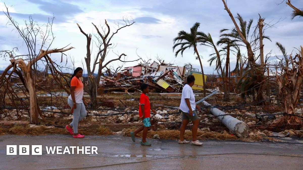
The 2025 Atlantic hurricane season will probably be remembered mainly for Hurricane Melissa and the devastation it caused across Jamaica and Cuba.
But it was also a season of stark contrasts, with periods of relative calm and bursts of intense activity.
The season managed to generate three Category 5 hurricanes - only the second season on record where that has happened. But during the typical mid-September peak things turned "remarkably" quiet.
Also notable, it was the first time since 2015 when no hurricane made landfall in the United States.
The North Atlantic hurricane season officially runs from 1 June to 30 November. However, the vast majority of tropical storm and hurricane activity typically occurs during the August-October period, which is considered to be the peak.
At the beginning of the year forecasters were predicting that 2025 would be an "above average" season.
Overall, National Oceanic and Atmospheric Administration (NOAA) report that the season fell within the ranges they had predicted for named storms, hurricanes, and major hurricanes.
This year there have been 13 named storms and five hurricanes, four of which strengthened to become major hurricanes.
How active a hurricane season has been can also be assessed by looking at the Accumulated Cyclone Energy or ACE Index. This reflects the strength or wind speed of each storm and how long it will last. For 2025 the total ACE is 132.9, which would indicate an above normal or very active season.
The 2025 season started with Tropical Storm Andrea on 23 June which was a short-lived storm that remained over open water in the Atlantic. At the end of the month Tropical Storm Barry formed in Mexico's Bay of Campeche and became the first to strike land, further up the coast near Tampico.
It was closely followed by Tropical Storm Chantal that hit South Carolina on 6 July and brought up to 6 inches of rain and subsequent flash flooding to North Carolina.
This turned out to be the only storm to make landfall in the US which is very unusual in any season. In fact the last time no hurricanes made landfall in the US was a decade ago.
The first hurricane in 2025 didn't develop until mid-August. But when it did, it was a big one.

Hurricane Erin became a major Category 5 hurricane on 16 August with sustained winds of 160mph (257km/h).
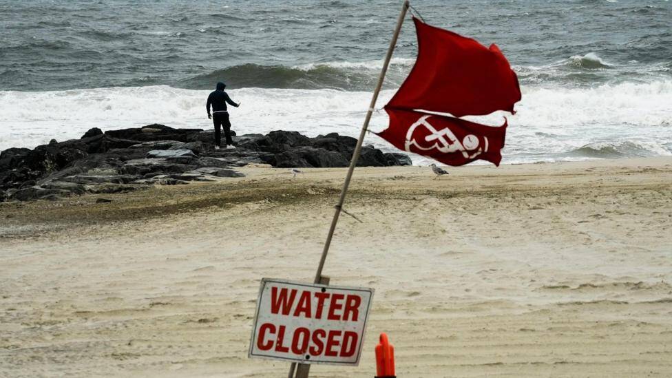
It passed near the Caribbean and skirted the US east coast. Although it did not make direct landfall it did produce dangerous rip currents and large surf which kept beaches closed and led to evacuations in some areas.
It was significant because it underwent an exceptionally rapid strengthening, going from a tropical storm to a Category 5 hurricane in about a day.
It later turned out that Erin wasn't the only storm to undergo explosive intensification with both hurricanes Humberto and Melissa following suit to reach Category 5 status.
This was only the second season on record with three Category 5 hurricanes.
Where did all the storms go?
What followed Erin was a "quite remarkable" quiet period in storm activity that coincided with the climatological peak of the Atlantic hurricane season.
A report from Colorado State University (CSU) highlighted three factors that could have led to a marked reduction in storm activity. These included a lack of moisture in the atmosphere, increased vertical wind shear that rips storms apart destroying them and a lack of thunderstorms off the west coast of Africa – typically a tropical storm formation area.
Forecasters suggested the lull in activity would be short-lived with a flurry of storms to come later in the season. And in due course two major hurricanes formed - Gabrielle and Humberto.
The track of these storms were affected by an area of high pressure known as the "Bermuda high". The high was weaker and displaced further east which resulted in both hurricanes being steered towards Bermuda and the mid-Atlantic rather than towards Florida, normally one of the hardest hit states during hurricane season.

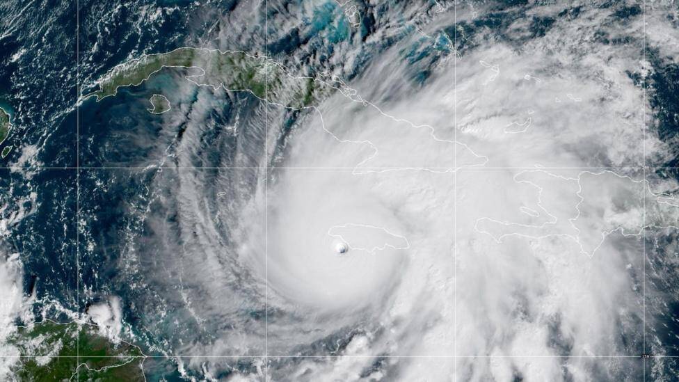
Up until this point it had been a quiet year for the Caribbean. But that changed late in October when Tropical Storm Melissa, to the south of Jamaica, strengthened to a category 4 hurricane within 24 hours, fuelled by unusually warm waters in the region.
After becoming slow-moving and bringing several days of damaging winds and flooding rains, Melissa made landfall in Jamaica on 28 October as a major category 5 hurricane with sustained winds of 185mph (297km/h).
Most years the island will feel the impacts of two or three tropical storms or hurricanes but only three hurricanes have directly hit the country since 1988.
Hurricane Melissa was the strongest storm ever to hit Jamaica and tied for the strongest hurricane to make landfall anywhere in the Atlantic basin.
Melissa went on the make a second landfall in eastern Cuba still as a major hurricane and brought widespread damage and flooding.
Melissa brought an abrupt but catastrophic end to the 2025 Atlantic hurricane season with no storms forming in November.
Role of climate change
A World Weather Attribution study has found that the atmospheric and ocean conditions that led to the rapid intensification of Hurricane Melissa were made six times more likely by climate change.
Climate change is not thought to increase the number of hurricanes, typhoons and cyclones worldwide but warmer oceans, coupled with a warmer atmosphere - fuelled by climate change - have the potential to make those that do form even more intense.
The frequency and magnitude of "rapid intensification events" in the Atlantic is also likely to have increased. This is where maximum wind speeds increase very quickly, as we saw with Erin and Melissa.
The speed of movement of storms seems to be slowing down too with the potential to give more rainfall, as we also saw with Hurricane Melissa.


